Monday, September 6, 2010
Monday, July 19, 2010
Back Home

We steamed home from the western Gulf to Pascagoula, around the Mississippi Delta, from Friday to Saturday. We saw lots of oil rigs, but no sign of oil in the water.
After 17 days at sea it was nice to be back on land. Teachers at Sea was a hands-on, total-immersion learning experience, unlike anything I've ever done before. I learned an amazing amount about the Gulf, the marine ecosystem, about how to do science at sea, and what it's like to live on a ship. You can't get that from a book, a video, a website or even a blog like this. You just have to get out there and do it.


Thursday, July 15, 2010
Last Day of Fishing
NOAA Teacher at Sea: Bruce Taterka
NOAA Ship: Oregon II
Mission: SEAMAP Summer Groundfish Survey
Geographical Area of Cruise: Gulf of Mexico
Date: Thursday, July 15, 2010
Weather Data from the Bridge
Time: 1400 (2:00 pm)
Position: Latitude 28.32.95 N, Longitude 93.50.85 W
Present Weather: 35% cloud cover
Visibility: 8 nautical miles
Wind Speed: 5 knots
Wave Height: 1-2 feet
Sea Water Temp: 31.6 C
Air Temperature: Dry bulb = 32.7 C; Wet bulb = 27.0 C
Barometric Pressure: 1016.84 mb
Science and Technology Log
NOAA has closed off a large portion of the Gulf to fishing and shrimping because of the oil spill, but based on fish samples and real-time data being collected on the Oregon II and other NOAA ships, the western Gulf still appears to be unaffected by oil. In fact, the Texas shrimp season opens today.
The second leg of the Oregon II’s Summer Groundfish survey is coming to its end. Today is our last day of fishing. Tomorrow we’ll spend cleaning up and steaming back to the ship’s home port of Pascagoula, Mississippi, which we’ll reach on Saturday and then I fly home Saturday afternoon. The map shows the ship’s track for the Summer Groundfish Survey. Leg 1 was from Pascagoula to Galveston. Leg 2, our current cruise, left from Galveston on July 1 and headed south, zigzagging our way down the coast almost to Mexico then  working our way back up, collecting samples and data the whole way.
This part of the Gulf has been oil free, but tomorrow on our way back to Pascagoula we should be going through the spill. Check back for pictures.
Earlier this week I got a chance to run the CTD from the lab. The graph on the computer screen shows the data being collected as the CTD drops to the sea floor. If you click on the picture to enlarge it, you can see the green line, which represents dissolved oxygen, dropping drastically towards the sea bottom. This indicates hypoxia – low dissolved oxygen at the sea floor.

This reading was from an area where the bottom was hypoxic, which resulted in a small catch in our trawl net. Yesterday, however, we got into less hypoxic waters and pulled in our biggest haul yet.

This is 380kg (~836lbs) of fish and invertebrates being hauled in. It took a long time to shovel into baskets, sort by species, measure, weigh, determine sex and enter the data into FSCS.

Personal Log
Yesterday some dolphins tried to steal our catch.


We caught a Bonnethead Shark, Sphyra tiburo, related to Hammerheads.

Monday, July 12, 2010
It's All Connected
NOAA Teacher at Sea: Bruce Taterka
NOAA Ship: Oregon II
Mission: SEAMAP Summer Groundfish Survey
Geographical Area of Cruise: Gulf of Mexico
Date: Tuesday, July 13, 2010
Weather Data from the Bridge
Time: 0015 (12:15 am)
Position: Latitude = 28.13.24 N; Longitude = 094.15.51 W
Present Weather: Cloud cover 20%
Visibility: 6-8 nautical miles
Wind Speed: 20 knots
Wave Height: 2-4 feet
Sea Water Temp: 29.4 C
Air Temperature: Dry bulb = 29.6 C; Wet bulb = 25.7 C
Barometric Pressure: 1011.96 mb
Science and Technology Log
“IT’S ALL CONNECTED.” If you took my Environmental Science class I hope you know what I’m talking about. Everything in an ecosystem is connected to everything else. This is a guiding principle of studying and managing ecosystems. I saw this last summer when I helped investigate the relationship between plants, caterpillars, parasitic wasps and climate change in the cloud forest of Ecuador. I see it in the relationship between human development, deer, invasive plants and native plants at the Schiff Nature Preserve in New Jersey.
I’m seeing it now in the Gulf of Mexico. Obviously, the ocean environment is connected to human activities – the BP-Deepwater Horizon oil spill makes that abundantly clear. But there are also countless natural connections, and much less obvious human impacts, that must be understood and assessed if the Gulf ecosystem is to be protected. Commercial fish and shrimp stocks can only be sustained through a careful understanding of the human impact and natural connections in the Gulf.
 Drilling platform off the coast of Texas.
That’s why we identify and count every organism we bring up in a trawl. Sometimes we get 50 or more different species in one catch, and we don’t just count the commercially important ones like red snapper and shrimp. We count the catfish, eel, starfish, sea squirts, hermit crabs and even jellyfish we haul in. Why? Because even though these organisms might seem “unimportant” to us, they might be important to the red snapper and shrimp. They also might be important to the organisms the red snapper and shrimp depend on. And even if they’re not directly important, studying them might tell us important things about the health of the Gulf.
 I’m learning a lot about this from the incredibly knowledgeable marine biologists in the science party. Brittany Palm is a Research Fishery Biologist from NOAA’s Southeast Fishery Science Center (SEFSC) in Pascagoula, MS, and leader of the day watch on this leg of the Oregon II’s Summer Groundfish Survey. Brittany is working on her M.S. on a fish called croaker, Micropogonias undulatus, studying its stomach contents to better understand its position in the food web. Croaker is not an economically important species, but it lives in the same shallow sea floor habitat as shrimp so shrimpers end up hauling in a huge amount of croaker as bycatch. So, when the shrimping industry declined in 2003-2004, the croaker population exploded. Since croaker are closely associated with shrimp habitat and the shrimp fishery, we might gain important insights by studying croaker population and understanding what they eat, and what eats them.
Alonzo Hamilton is another NOAA Fishery Biologist from the SEFSC. Alonzo explained to me that there’s a lot to be learned by looking at the whole ecosystem, not just the 23 commercial species that are managed in the Gulf. For example, many of the crabs we commonly catch in our trawls are in the genus Portunas, known as “swimming crabs.” Portunas species normally live on the sea floor, but when severe hypoxia sets in, Portunas crabs can be found at the surface, trying to escape the sever oxygen depletion that typically takes place at the bottom of the water column.

Portunas spinicarpus
Sean Lucey is a Research Fishery Biologist from NOAA’s Northeast Fishery Science Cent er in Woods Hole, Massachusetts. He’s working on the Oregon II right now to support the SEFSC because of huge manpower effort demanded by the oil spill. Sean explained that the NEFSC has been conducting its groundfish survey annually since 1963, making it the longest-running study of its kind. Originally the survey only looked at groundfish population, but as our understanding of ecosystem dynamics increased over time, more and more factors were analyzed. Now NEFSC looks at sex, age, stomach contents and many other species besides groundfish to obtain a more complete picture of the food web and the abiotic factors that affect groundfish. NEFSC even measures primary production in the marine ecosystem as one tool to estimate the potential biomass of groundfish and other species at higher trophic levels.
 Andre DeBose is a NOAA Fishery Biologist from the SEFSC and the Field Party Chief for the Summer Groundfish Survey. In addition to leading the science team on the Oregon II, Andre is conducting research on Rough Scad, Trachurus lathami, an important food species for red snapper and important bait fish for red snapper fisherman. By gaining a better understanding of the relationship between Red Snapper and its prey we can better understand, and better manage, the ecosystem as a whole.
There’s a lot of information to be learned beyond just counting fish. By taking a wide look at the marine environment we can better understand how the whole ecosystem functions. This enables us not only to be more informed in setting sustainable catch levels, but also enables us to identify and respond to things that contribute to hypoxia and other problems that degrade habitat and reduce populations. It’s all connected.

NOAA Ship: Oregon II
Mission: SEAMAP Summer Groundfish Survey
Geographical Area of Cruise: Gulf of Mexico
Date: Tuesday, July 13, 2010
Weather Data from the Bridge
Time: 0015 (12:15 am)
Position: Latitude = 28.13.24 N; Longitude = 094.15.51 W
Present Weather: Cloud cover 20%
Visibility: 6-8 nautical miles
Wind Speed: 20 knots
Wave Height: 2-4 feet
Sea Water Temp: 29.4 C
Air Temperature: Dry bulb = 29.6 C; Wet bulb = 25.7 C
Barometric Pressure: 1011.96 mb
Science and Technology Log
“IT’S ALL CONNECTED.” If you took my Environmental Science class I hope you know what I’m talking about. Everything in an ecosystem is connected to everything else. This is a guiding principle of studying and managing ecosystems. I saw this last summer when I helped investigate the relationship between plants, caterpillars, parasitic wasps and climate change in the cloud forest of Ecuador. I see it in the relationship between human development, deer, invasive plants and native plants at the Schiff Nature Preserve in New Jersey.
I’m seeing it now in the Gulf of Mexico. Obviously, the ocean environment is connected to human activities – the BP-Deepwater Horizon oil spill makes that abundantly clear. But there are also countless natural connections, and much less obvious human impacts, that must be understood and assessed if the Gulf ecosystem is to be protected. Commercial fish and shrimp stocks can only be sustained through a careful understanding of the human impact and natural connections in the Gulf.
 Drilling platform off the coast of Texas.
 I’m learning a lot about this from the incredibly knowledgeable marine biologists in the science party. Brittany Palm is a Research Fishery Biologist from NOAA’s Southeast Fishery Science Center (SEFSC) in Pascagoula, MS, and leader of the day watch on this leg of the Oregon II’s Summer Groundfish Survey. Brittany is working on her M.S. on a fish called croaker, Micropogonias undulatus, studying its stomach contents to better understand its position in the food web. Croaker is not an economically important species, but it lives in the same shallow sea floor habitat as shrimp so shrimpers end up hauling in a huge amount of croaker as bycatch. So, when the shrimping industry declined in 2003-2004, the croaker population exploded. Since croaker are closely associated with shrimp habitat and the shrimp fishery, we might gain important insights by studying croaker population and understanding what they eat, and what eats them.
Alonzo Hamilton is another NOAA Fishery Biologist from the SEFSC. Alonzo explained to me that there’s a lot to be learned by looking at the whole ecosystem, not just the 23 commercial species that are managed in the Gulf. For example, many of the crabs we commonly catch in our trawls are in the genus Portunas, known as “swimming crabs.” Portunas species normally live on the sea floor, but when severe hypoxia sets in, Portunas crabs can be found at the surface, trying to escape the sever oxygen depletion that typically takes place at the bottom of the water column.

Portunas spinicarpus
Sean Lucey is a Research Fishery Biologist from NOAA’s Northeast Fishery Science Cent
 er in Woods Hole, Massachusetts. He’s working on the Oregon II right now to support the SEFSC because of huge manpower effort demanded by the oil spill. Sean explained that the NEFSC has been conducting its groundfish survey annually since 1963, making it the longest-running study of its kind. Originally the survey only looked at groundfish population, but as our understanding of ecosystem dynamics increased over time, more and more factors were analyzed. Now NEFSC looks at sex, age, stomach contents and many other species besides groundfish to obtain a more complete picture of the food web and the abiotic factors that affect groundfish. NEFSC even measures primary production in the marine ecosystem as one tool to estimate the potential biomass of groundfish and other species at higher trophic levels.
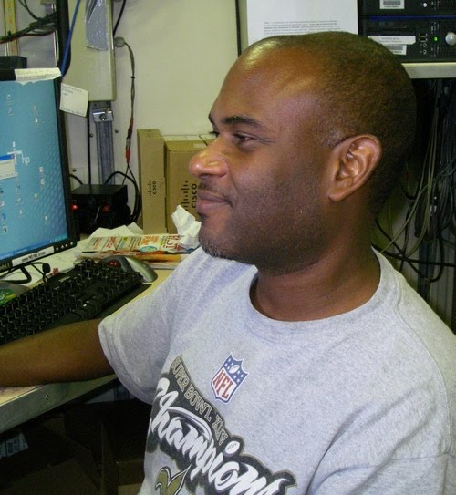 Andre DeBose is a NOAA Fishery Biologist from the SEFSC and the Field Party Chief for the Summer Groundfish Survey. In addition to leading the science team on the Oregon II, Andre is conducting research on Rough Scad, Trachurus lathami, an important food species for red snapper and important bait fish for red snapper fisherman. By gaining a better understanding of the relationship between Red Snapper and its prey we can better understand, and better manage, the ecosystem as a whole.
There’s a lot of information to be learned beyond just counting fish. By taking a wide look at the marine environment we can better understand how the whole ecosystem functions. This enables us not only to be more informed in setting sustainable catch levels, but also enables us to identify and respond to things that contribute to hypoxia and other problems that degrade habitat and reduce populations. It’s all connected.

Sunday, July 11, 2010
Sorting the Catch
NOAA Teacher at Sea: Bruce Taterka
NOAA Ship:
Geographical Area of Cruise:
Date:
Weather Data from the Bridge
Time: 0730 (
Position: Latitude 28.18.6 N; Longitude 95.19.4 W
Present Weather: party cloudy
Visibility: 10 nautical miles
Wind Speed: 12.35 knots
Wave Height: 2 feet
Sea Water Temp: 28.9 C
Air Temperature: Dry bulb = 29.1 C; Wet bulb = 25.4 C
Barometric Pressure: 1014.30 mb
Science and Technology Log
Kim and I have blogged about some of the tools we use aboard the Oregon II like FSCS, CTD, Bongos and the Neuston. But what, you ask, are some other tools we use that are not high tech?

Believe it or not, shovels, baskets and trays are important tools on the ground fish survey. When a catch comes in the net is held by a crane and emptied into baskets, but a lot flops out onto the deck. We use shovels to pick up the rest. In the wet lab we use small shovels to move the catch along and trays to sort the organisms by species. (Check out the video below!) When it comes to identification paperback field guides and laminated posters can help with ID.
Once we sort the catch, certain species have to be prepared and saved for research. Some specimens go to university scientists. For example, we bag and freeze specimens of batfish for an ongoing research study.

Slantbrow batfish, Ogcocephalaus declivirostris
For food species like shrimp and red snapper, we bag specimens to go to NSIL (National Seafood Inspection Lab). This is especially important now because of the oil spill –seafood samples are being tested to determine what parts of the Gulf can be opened to commercial fishing. Samples from leg I of the Groundfish Survey are going to be sensory tested, or “sniff” tested. For this test we have to wrap the specimens in foil to contain any scents so that the ‘sniff testers’ (people trained to pick up petroleum scent at an amazing 100 ppm) can identify if petroleum products are present. For leg II the focus is on chemical sampling for petroleum. However, protocols can change daily when you are sampling during a disaster. Here’s a link to a recent news story on testing the fish we’re catching and sending to the lab: http://www.cnn.com/video/#/video/us/2010/07/09/gupta.seafood.test.cnn
Personal Log:
We've been seeing lots of cool stuff. Yesterday we were trailed by a school of sharks for most of the day.

Here's a shark circling our CTD.

We also caught a large Roughtail Stingray, Dasyatis centroura, in our trawl.

He swam away feeling fine.

Here's a video showing us processing a catch yesterday. It's a time lapse showing in 2 1/2 minutes the 45-minute process of sorting the 57 kg(~125 lbs) into 55 different species.
Thursday, July 8, 2010
Sexing the Catch
NOAA Teacher at Sea: Bruce Taterka
NOAA Ship:
Geographical Area of Cruise:
Date:
Weather Data from the Bridge
Time: 1630 (
Position: Latitude = 28.20.93 N; Longitude = 095.58.98 W
Present Weather: Could cover 100%
Visibility: 4-6 nautical miles
Wind Speed: 18 knots
Wave Height: 6-8 feet
Sea Water Temp: 28.9 C
Air Temperature: Dry bulb = 27.2 C; Wet bulb = 25.3 C
Barometric Pressure: 1011.56 mb
Science and Technology Log
As you can tell from our previous blogs, we spend a lot of our time on the Oregon II counting, measuring and weighing our catch and loading the data into FSCS. These data are critical to NOAA and the states in managing fish stocks and the Gulf ecosystem. In addition to knowing population size, weights, and lengths of individuals it’s also important to know the sex of the organisms. Information on the male:female ratio helps NOAA and the states assess the ability of the population to reproduce, and to establish sustainable catch levels for commercial fishing.
But how do you determine the sex of marine organisms? For most fish and invertebrates you can only tell the sex by internal anatomy, which almost always requires cutting the animal open. This is time consuming and not always practical when we have a large catch to process and other tasks take priority, such as preparing samples to be analyzed for contamination from the oil spill which is our top priority right now.
For some organisms, however, sex can be determined externally. One of the things we’ve learned in the past week is how to determine the sex of shrimp, flatfish, crabs, sharks, skates and rays. Here’s how:
Shrimp: the males have a pair of claspers (called petasma) on their first set of legs. The petasma are absent in females. The males use the petasma during mating to grasp the female and transfer the sperm sac.


Female - petasma are absent
Crabs: On most crab species females have wide plates curving around the rear of the abdomen, while males have a long narrow plate or plates. On females, the eggs develop under the curved plate.

Male

Female

Female with eggs
Flatfish: When you hold a flatfish up to the light you can see through it, which enables you to do an internal examination without cutting it open. On female flatfish, the gonad extends in a dark red, curved wedge which is absent in the male.

Female showing long curved gonad

Male - long gonad is absent
Sharks, skates and rays. Males have external claspers that they use in mating, while in females the cloaca is smooth and claspers are absent.

Male Angel shark - arrows point to claspers

Female Angel shark - claspers are absent
Personal Log
A tropical depression moved through the Gulf yesterday evening, making it too rough and windy to fish. So instead of counting, measuring and loading data into FSCS, my watchmates and I cleaned the lab, secured our gear, and headed up to the lounge to watch
Wednesday, July 7, 2010
Trawling in Deeper Waters
NOAA Teacher at Sea: Bruce Taterka
NOAA Ship:
Geographical Area of Cruise:
Date: Wednesday, July 7, 2010
Weather Data from the Bridge
Time: 2015 (8:15pm)
Position: Latitude = 27.20.39 N; Longitude = 096.35.21 W
Present Weather: Could cover 90%
Visibility: 4-6 nautical miles
Wind Speed: 15 knots
Wave Height: 2-4 feet
Sea Water Temp: 28.6 C
Air Temperature: Dry bulb = 28.5 C; Wet bulb = 26.7 C
Barometric Pressure: 1008.27 mb
Science and Technology Log
Since setting out on Friday we’ve headed south along the Gulf coast of
Ten-foot seas are predicted for tonight so we’re heading north along the Texas coast, away from the storm, and we've put away the fishing gear until it gets calmer.
Last log we talked about FSCS (Fisheries Scientific Computer System). So what is it, how is it used, and what is so great about it?
FSCS, pronounced ‘fiscus’, is an automated system for recording the massive amount of biological and oceanographic data generated 24 hours a day by NOAA scientists during fisheries surveys. During a trawl survey, fish and invertebrates from each haul are sorted, counted and weighed by species. Scientists record data from individual fish, such as sex, weight, length and even stomach contents, resulting in tens of thousands of new data points every day. Before NOAA rolled out FSCS in 2001 aboard the ship Albatross IV, scientists recorded all data by hand, an incredibly tedious process. With FSCS, however, data are recorded digitally which is much faster, allows integration of biological and oceanographic data. It also enables NOAA to obtain critical real-time information to assess and manage the health of the marine ecosystem and individual fish stocks.
FSCS uses a Limnoterra FMB4 (fish measuring board) which has a magnetic pen to upload the length of an organism within a millimeter, and software that annotates all of the data on length, mass, sex, etc. The software has an index of species scientific names and can print labels for specimen samples that are to be shipped to other scientists and to the National Seafood Inspection Laboratory in
We use FSCS 24 hours a day, and I can't imagine how NOAA scientists did this work without it.
Personal Log
I'm enjoying my 12-hour shifts processing fish, shrimp and invertebrates on the Oregon II. Our noon-to-midnight watch is working well together and starting to bond.

My watch-mates in the Oregon II wet lab.
I'm seeing lots of very cool marine life that we're hauling up from the bottom of the Gulf with our trawling net. Here are just a few of the things I've seen in the past two days:

Singlespot frogfish - Antennarius radiosus.
Note the lure on its snout.

Examining the stomach contents of a catfish.

Red snapper - Lutjanus campechanus.

Camoflage in the Sargassum. Can you spot the crabs?

Subscribe to:
Posts (Atom)